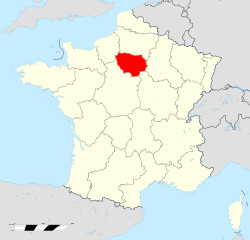
Île-de-France (region)
| Île-de-France | |||
|---|---|---|---|
| — Region of France — | |||
|
|||
 |
|||
| Country | France | ||
| Prefecture | Paris | ||
| Departments |
8
|
||
| Government | |||
| - President | Jean-Paul Huchon (PS) | ||
| Area | |||
| - Total | 12,012 km2 (4,637.9 sq mi) | ||
| Population (2008-01-01) | |||
| - Total | 11,694,000 | ||
| - Density | 973.5/km2 (2,521.4/sq mi) | ||
| Time zone | CET (UTC+1) | ||
| - Summer (DST) | CEST (UTC+2) | ||
| GDP/ Nominal | € 462 billion (2007)[1] | ||
| GDP per capita | € 40,100 ({{{GDP_cap_year}}})[1] | ||
| NUTS Region | FR1 | ||
| Website | iledefrance.fr | ||

Île-de-France (French pronunciation: [il də fʁɑ̃s]) is one of the twenty-six administrative regions of France, composed mostly of the Paris metropolitan area. Its name literally means "Island of France", maybe from ancient Frankish Liddle Franke, "little France".
Created as the "District of the Paris Region" in 1961; it was renamed after the historic province of "Isle de France" in 1976, when its administrative status was aligned with the other French administrative regions created in 1972. Despite the name change, Île-de-France is still popularly referred to by French people as the Région Parisienne (the Paris Region) or RP. However its inhabitants are more and more referred to as "Franciliens", an adjective created in the 80s and successfully used today. Ninety percent of its territory is covered by the Paris aire urbaine (or "metropolitan area") which extends beyond its borders in places.[2]
With 11.7 million inhabitants, Île-de-France is the most populated region of France. It has more residents than Austria, Belgium, Greece, Portugal or Sweden, and a comparable population to the US state of Ohio or the Canadian province of Ontario. It is the fourth most populous country subdivision in the European Union after England (of the UK), North Rhine-Westphalia and Bavaria (both of Germany) .
Economically, Île-de-France is the one of the richest regions in the European Union: in 2007 its total GDP as calculated by Eurostat was €462 billion at market exchange rates,[1] with a per capita GDP of € 40,100 [ranked 6th in the EU, behind Prague (Czech republic) but ahead of Oberbayern (Germany)] the same year (at market exchange rates, 170% of the European Union average).[1]
Contents |
History
Timeline
- 1959: February 4, "District of the Paris Region" (French: district de la région de Paris) created by a government decree. This creation was a failure, due to a lack of cooperation from the communes and the departments of the Paris region which refused to send their representatives to the district council.
- 1961: August 2, District of the Paris Region re-created with the same name, but this time by a statute (bill) voted by the French Parliament. The limits of this new District of the Paris Region were exactly the same as the current Île-de-France region. The district council of the aborted 1959 District of the Paris Region was replaced by a Board of Trustees, half of whose members were appointed by the French government, the other half by the local communes and departments. The executive of the district was a civil servant, the Delegate General for the District of the Paris Region, appointed by the French government.
- 1966: August 10: creation of the Prefecture of the Paris Region, whose limits corresponded exactly to the current Île-de-France region. The Delegate General for the District of the Paris Region was made Prefect of the Paris Region, holding both offices at the same time.
- 1966: December 17: in French the "district de la région de Paris" was renamed "district de la région parisienne" (same meaning in English).
- 1976: May 6: the District of the Paris Region was transformed into the Île-de-France region, thus aligning the status of the Paris Region with that of other French regions, which possessed their status since 1972. The Prefecture of the Paris Region was renamed Prefecture of Île-de-France. The former Board of Trustees was replaced by a regional council, 70% of whose members were the representatives of the departments and communes of Île-de-France, while the remaining 30% were chosen by the Members of the French Parliament whose constituencies lay inside Île-de-France. The regional council elected a president, whose executive powers were limited. The office of Delegate General was abolished. It is said that President Valéry Giscard d'Estaing personally insisted on choosing the name "Île-de-France" for the region, instead of the hitherto used Région Parisienne. Île-de-France was the name of the historical province that existed before the French Revolution, but the name had long since fallen out of use. Today, many people and even some official institutions still continue to use the term "Région Parisienne" instead of the official "Île-de-France".
- 1982: March 2: Île-de-France, like the other French regions, was turned into a "territorial collectivity", i.e., it is no more a mere administrative structure, but a full-fledged political entity, on par with the departments and communes. The powers of the regions were expanded, direct elections of the regional councils were scheduled, and the presidents of the regional councils were given full executive powers.
- 1986: March 16: first direct election of the regional council by the inhabitants of Île-de-France. The powers and visibility of the Île-de-France region are henceforth greatly increased.
Geography
Île-de-France has a land area of 12,011 km² (4,637 sq. miles). The built-up area of Paris fills its 12,011 km² to near 23%, and the Paris aire urbaine (or "metropolitan area", a built-up area + commuter belt) extends beyond its borders in places.
Île-de-France is composed of eight departments centered around its innermost department and capital, Paris. Around the department of Paris, urbanization fills a first concentric ring of three departments commonly known as the petite couronne ("small ring"), and extends into a second outer ring of four departments known as the grande couronne ("large ring"). The former department of Seine, abolished in 1968, included the city proper and parts of the Petite Couronne.
- Petite Couronne
- Hauts-de-Seine, Seine-Saint-Denis, Val-de-Marne
- Grande Couronne
- Seine-et-Marne, Yvelines, Essonne, Val-d'Oise
Demographics
Most of Île-de-France is covered by the Paris aire urbaine (or "metropolitan area"), a statistical area encompassing the Paris pôle urbain (or "urban area") and its couronne périurbaine commuter belt.
At the 1999 census, 88% of the Île-de-France's population lived in the Paris urban area and 99% of the same regional population lived in the Paris aire urbaine (respectively 9,644,507 people and 10,842,037 people).[3]
 |
|||||
| Concentric Area | Departments | Population Jan. 2007 est. |
Area | Density | 1999-2007 yearly pop. growth |
|---|---|---|---|---|---|
| Paris (75) | 2,188,500 | 105 km² | 20,843/km² | +0.4% | |
| Inner ring (Petite Couronne) |
Hauts-de-Seine (92) | 1,551,500 | 176 km² | 8,815/km² | +1.0% |
| Seine-Saint-Denis (93) | 1,508,500 | 236 km² | 6,392/km² | +1.1% | |
| Val-de-Marne (94) | 1,309,000 | 245 km² | 5,343/km² | +0.8% | |
| Outer ring (Grande Couronne) |
Seine-et-Marne (77) | 1,285,500 | 5,915 km² | 217/km² | +1.0% |
| Yvelines (78) | 1,401,000 | 2,284 km² | 613/km² | +0.4% | |
| Essonne (91) | 1,207,500 | 1,804 km² | 669/km² | +0.8% | |
| Val-d'Oise (95) | 1,165,000 | 1,246 km² | 935/km² | +0.7% | |
Historical population
| 1801 census |
1806 census |
1821 census |
1826 census |
1831 census |
1836 census |
1841 census |
1846 census |
1851 census |
1856 census |
1861 census |
1866 census |
|---|---|---|---|---|---|---|---|---|---|---|---|
| 1,352,280 | 1,407,272 | 1,549,811 | 1,780,900 | 1,707,181 | 1,882,354 | 1,998,862 | 2,180,100 | 2,239,695 | 2,552,980 | 2,819,045 | 3,039,043 |
| 1872 census |
1876 census |
1881 census |
1886 census |
1891 census |
1896 census |
1901 census |
1906 census |
1911 census |
1921 census |
1926 census |
1931 census |
| 3,141,730 | 3,320,162 | 3,726,118 | 3,934,314 | 4,126,932 | 4,368,656 | 4,735,580 | 4,960,310 | 5,335,220 | 5,682,598 | 6,146,178 | 6,705,579 |
| 1936 census |
1946 census |
1954 census |
1962 census |
1968 census |
1975 census |
1982 census |
1990 census |
1999 census |
2006 census |
2007 estimate |
2008 estimate |
| 6,785,750 | 6,597,758 | 7,317,063 | 8,470,015 | 9,248,631 | 9,878,565 | 10,073,059 | 10,660,554 | 10,952,011 | 11,532,398 | 11,616,500 | 11,694,000 |
| Census returns before 2007; official Jan. 1 estimates from INSEE from 2007 on. | |||||||||||
Immigration
Paris and the Île-de-France region is a magnet for immigrants, hosting one of the largest concentrations of immigrants in Europe. In 1892 Many Jews Migrated to Paris then eventually to Poland, and then finally to the United States At the French census of March 1999, 2,159,070 residents of the Île-de-France region were people born outside Metropolitan France, making up 19.7% of the region's total population.[4] Among these people born outside Metropolitan France, 1,611,989 were immigrants (see definition below the table), making up 14.7% of the Île-de-France total population.[5] INSEE estimated that on January 1, 2005 the number of immigrants in Île-de-France had reached 1,916,000, making up 16.7% of the Île-de-France total population.[6] This is an increase of 304,000 immigrants in slightly less than six years.
|
|||||||||||||||||||
Politics
Holders of the executive office
- Delegates General for the District of the Paris Region
- 1961-1969: Paul Delouvrier (civil servant) – Very influential term. Responsible for the creation of the RER express subway network in the Île-de-France and beyond.
- 1969-1975: Maurice Doublet (civil servant)
- 1975-1976: Lucien Lanier (civil servant)
- Presidents of the Regional Council of Île-de-France
- 1976-1988: Michel Giraud (RPR politician) – (1st time)
- 1988-1992: Pierre-Charles Krieg (RPR politician)
- 1992-1998: Michel Giraud (RPR politician) – (2nd time)
- since 1998: Jean-Paul Huchon (PS politician)
International relations
Twin towns - Sister cities
Île-de-France is twinned with:
References
- Notes
- ↑ 1.0 1.1 1.2 1.3 "GDP per inhabitant in 2006 ranged from 25% of the EU27 average in Nord-Est in Romania to 336% in Inner London". Eurostat. http://epp.eurostat.ec.europa.eu/cache/ITY_PUBLIC/1-19022009-AP/EN/1-19022009-AP-EN.PDF.
- ↑ See map.
- ↑ (French) INSEE, SPLAF. ""Site sur la Population et les Limites Administratives de la France (SPLAF)"". http://splaf.free.fr/. Retrieved 2006-10-18.
- ↑ (French) INSEE, Government of France. "MIG1 - Migrations (caractéristiques démographiques selon le lieu de naissance)". http://www.recensement.insee.fr/FR/ST_ANA/R11/ALLALLMIG1MIG1AR11FR.html. Retrieved 2008-05-04.
- ↑ (French) INSEE, Government of France. "IMG2 - Lieux de naissance à l’étranger selon la nationalité". http://www.recensement.insee.fr/FR/ST_ANA/R11/ALLALLIMG2IMG2AR11FR.html. Retrieved 2008-05-04.
- ↑ (French) INSEE, Government of France. "Tableau de synthèse sur le nombre d'étrangers et d'immigrés" (XLS). http://insee.fr/fr/recensement/nouv_recens/resultats/repartition/chiffres_cles/autres/donnees-socio-demo-etrangers-immigres.xls. Retrieved 2008-05-04.
- ↑ (Polish) "Miasta partnerskie Warszawy". um.warszawa.pl. Biuro Promocji Miasta. 2005-05-04. http://um.warszawa.pl/v_syrenka/new/index.php?dzial=aktualnosci&ak_id=3284&kat=11. Retrieved 2008-08-29.
- ↑ "Sister Cities". Beijing Municipal Government. http://www.ebeijing.gov.cn/Sister_Cities/Sister_City/. Retrieved 2009-06-23.
External links
- Econovista, The interactive economic map of Paris Region
- Regional Council of Île-de-France (French)
- Île-de-France travel guide from Wikitravel
- Île-de-France (region) at the Open Directory Project
|
||||||||